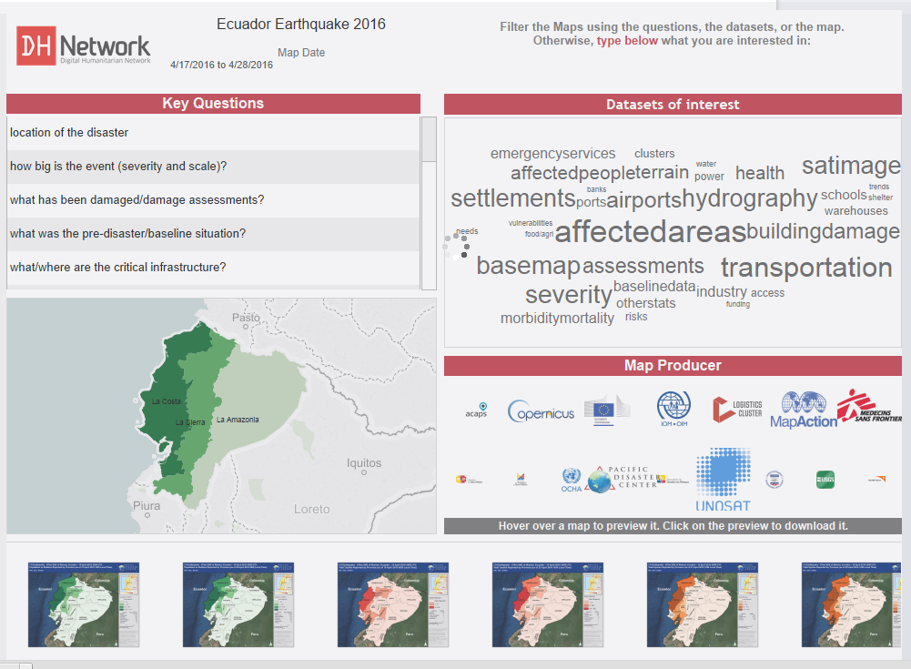
Improving access to maps during emergency response – Hurricane Matthew
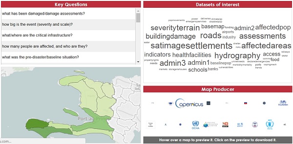
GISCorps helped build a new tool to improve access to vital information in emergency response The map filter project is a new technique being developed to help decision makers find the right information at the right time during emergency response. More…