
Project Mission In 2025, I partnered with the Coastal Plains Institute (CPI) to assist with…
Across the United States, 4-H Geospatial programs introduce young people to geographic information systems (GIS), spatial analysis, and data-driven decision-making through hands-on projects and mentorship opportunities. These experiences allow students to explore real-world challenges while developing valuable technical and analytical skills.
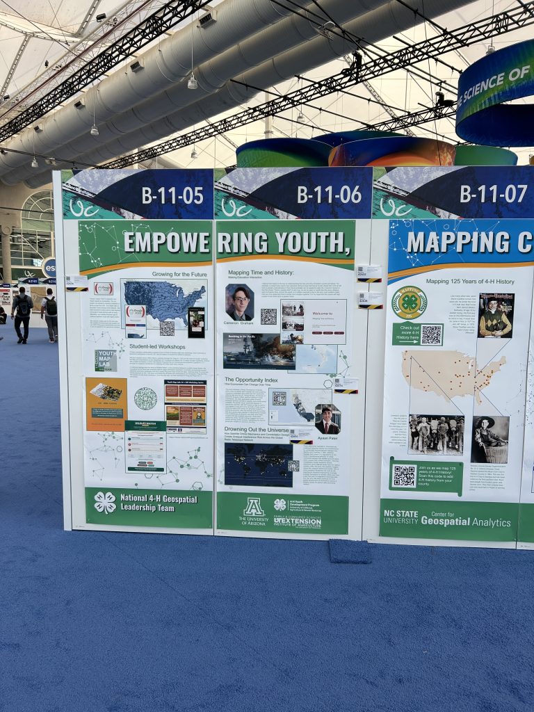
In partnership with Dr. Thomas Ray and the National 4-H Geospatial Leadership Team, GISCorps volunteers Samantha Olivieri (Wisconsin) and Meredith Lowden (New Jersey) returned for a third year to mentor students as they developed cartographic products for display in the Esri User Conference Map Gallery. Building on the success of the 2024 and 2025 programs, the volunteers helped students strengthen their cartographic, analytical, and presentation skills while preparing professional-quality maps and StoryMaps.
The program began with training on cartographic best practices, map design principles, and effective data visualization techniques. Students learned how to use ArcGIS Pro and ArcGIS Online to communicate complex information clearly and effectively. Throughout the project, students developed draft maps and participated in one-on-one review sessions, receiving individualized feedback on map layout, symbology, analysis methods, and storytelling approaches.
The students’ final projects showcased both technical expertise and creativity. Topics included coastal resilience in North Carolina, grocery price tracking, GDP trends, healthcare access, air pollution and lung cancer, voting and diabetes, extreme weather readiness, data center impacts, wildfire mitigation using machine learning, satellite interference risk management, opportunity and equity indices, literature geography, economic trends, and global supply chains.
Working primarily in a virtual environment, with some students attending the Esri User Conference in person, participants produced large-format maps, analytical reports, and ArcGIS Online StoryMaps that highlighted both their research findings and their growing GIS expertise (link to Esri’s Map Gallery Site).
This ongoing collaboration between GISCorps and 4-H demonstrates the power of mentorship in developing future geospatial leaders. By connecting experienced GIS professionals with students eager to learn, the program fosters technical skills, critical thinking, curiosity, and a passion for solving real-world challenges through geospatial technology.
These students are already demonstrating the impact GIS can have on understanding and improving our world, and they represent a bright future for the geospatial profession.


Volunteer Testimonial
“One of the most rewarding aspects of volunteering with the 4-H Geospatial Team is seeing students apply GIS to topics that they’re genuinely passionate about. Their creativity, curiosity, and willingness to tackle complex issues continue to impress us year after year.”
– Meredith Lowden, GISCorps Volunteer
Project Complete

Related Missions


