
Volunteers Update Building Outlines in Southwest Louisiana
126 volunteers spent five days editing or adding 70,000 building outlines in areas affected by Hurricane Laura for a FEMA damage assessment.

ArcGIS Online focused projects (Apps, Story Maps, Web Maps)
126 volunteers spent five days editing or adding 70,000 building outlines in areas affected by Hurricane Laura for a FEMA damage assessment.

Hurricane Laura became the first major hurricane of the 2020 Atlantic storm season as it trekked across the Gulf of Mexico towards the Louisiana/Texas border. The National Alliance for Public Safety GIS Foundation (NAPSG) requested support from GISCorps volunteers for…

Hurricane Isaias was the second hurricane of the 2020 Atlantic storm season. The National Alliance for Public Safety GIS Foundation (NAPSG) requested support from GISCorps volunteers for the long-standing Disaster Crowdsource Photos effort, to provide situational awarness to emergency managers. While the storm…

Hurricane Hanna became the first hurricane of the 2020 season on July 25,2020, brining heavy rain and storm surge flooding to South Texas. The National Alliance for Public Safety GIS Foundation (NAPSG) requested support from GISCorps volunteers for the long-standing…

Tropical Storm Cristobal formed in the Bay of Campeche on June 1st. After impacting Mexico, it moved north across the Gulf of Mexico and made landfall in Southeastern Louisiana on June 7, 2020. On June 5 in advance of the…
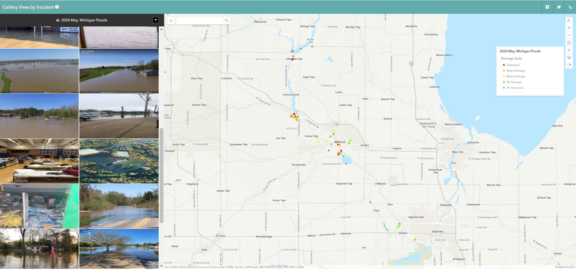
On May 19th, two dams on Central Michigan’s Tittabawassee River failed after days of heavy rain inundated the area, forcing the evacuations of the towns of Edenville, Sanford, and Midland. NAPSG Foundation once again called on GISCorps to help map…

I used the personal use license I was granted through the GIS Service Pledge program to build a web application to enable anyone to submit an anonymous report documenting their grocery shopping experience during the COVID-19 pandemic. My hope was…
One Shared Story is a volunteer-based non-profit organization founded in 2018. One Shared Story volunteers assist community groups in researching, preserving, and curating hidden histories. 18th and 19th century documents omit full names of women, enslaved persons, and people of…

Following the tornado outbreak in South Carolina on April 12, the South Carolina Emergency Response Task Force (SCERTF) via the National Alliance For Public Safety GIS (NAPSG) Foundation requested help from GISCorps for a quick-turnaround QA/QC project for Seneca, SC…

On April 12-13, a series of devastating tornadoes touched down across the Southeastern United States. Mississippi, Alabama, and South Carolina were particularly hard hit. On April 13, the National Alliance for Public Safety GIS Foundation (NAPSG) asked GISCorps to request…