
Overview The #PhotoMappers project is in its 11th year of providing situational awareness to federal,…
Following the tornado outbreak in South Carolina on April 12, the South Carolina Emergency Response Task Force (SCERTF) via the National Alliance For Public Safety GIS (NAPSG) Foundation requested help from GISCorps for a quick-turnaround QA/QC project for Seneca, SC. Two volunteers, local to South Carolina, were chosen within 24 hours to help with the project, using ArcGIS Online web applications. Their story in their own words follows.
_____________________________________
Volunteers
Dawn Misura, GISP
I often see requests for volunteers from GISCorps but rarely is the project in my own back yard. Having seen the devastation in South Carolina on the local news, I knew that this was something that I wanted to help out with. I work in the Technology Development Program of the South Carolina Department of Natural Resources. I have been doing GIS for 16 years in a great variety of projects, but I have never had the chance to work near real time in a natural disaster. This is my first time volunteering with the GISCorps and I look forward to doing it again. It was quite exciting and humbling to know that the work that we were doing would be important in helping the community of Seneca recover from this catastrophic event.
Rachel Passer, GISP
I am a GIS Research Associate/Cartographer at the University of South Carolina’s Institute for Families in Society. I am also a GISCorps member, and I was contacted to participate in this effort since I live in South Carolina. The reason I volunteer with GISCorps is that I like having opportunities to occasionally do different kinds of GIS. I had previously volunteered on the geolocation of crowdsourced photos for the southeast tornado outbreak the week prior, so I was happy to participate in another southeast tornado project.
Seeking Volunteers
GISCorps sent a time-sensitive email that the South Carolina Emergency Response Task Force (SCERTF) in coordination with the NAPSG Foundation was looking for 2 volunteers based in South Carolina to provide QA/QC support for data compiled after tornadoes touched down in our state recently.
After the tornadoes struck, Task Force SAR teams performed rapid damage assessments using a Survey 123 form, which became points on a web map application. However, many of the points were mislocated or had minor data entry errors. Because of this, they looked to GISCorps volunteers to go in and QA/QC the tornado damage points to assess, correct, and validate Damaged, Failed, and Destroyed points.
QA/QC Process
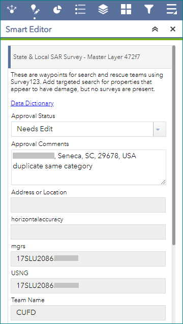
We were asked to QA/QC damaged, failed, and destroyed points in the town of Seneca, which is located in Oconee County, a rural part of northern South Carolina that approaches the Blue Ridge Mountains. The QA/QC process involved volunteers grabbing one of the grids covering Seneca, using the Smart Editor to change its status to ‘In Progress’ with our name attached, so others involved in the effort could determine who was working on what. Within each grid, we went through all the points needing our attention, again using the Smart Editor to move the points onto the buildings, provide comments when needed, and approve those points once moved to their correct location.
Of these points in Seneca, 520 of 1,495 survey points (≈35%) were outside of a parcel polygon, which makes them difficult to use in a damage assessment. This was due to the fact that for some first responders, it was the first time they had used this application and life safety is their first concern. A remote QA/QC Process was developed to move 99% of the damaged, failed, and destroyed surveys onto Oconee County parcels. This involved GISCorps volunteers for +16 hours of combined effort to complete. The GISCorps QA/QC and analysis of the data is helping SCERTF be better prepared for their next damage assessment. Most importantly they learned, when using Survey123 always ‘drag the pin’ to the building you are surveying.

To find out more about the tools used by SCERTF for their field situational awareness, see https://sargis.napsgfoundation.org/pages/usar.
Takeaway
Volunteering my time for GISCorps was a rewarding effort. Communication from NAPSG, SCERTF, and GISCorps was excellent and made the process go very smoothly. I was also impressed with the use of ArcGIS Online to make all of these web applications that proved to be very useful in emergency response efforts. I’m glad there are resources such as the aforementioned organizations that make it easy for professionals like myself to contribute to a worthwhile effort. – Rachel Passer, GISP
GISCorps provides on opportunity for GIS professionals to step outside of their everyday work and participate in projects of great meaning. – Dawn Misura, GISP
Related Missions


