Volunteers Update Building Outlines in Southwest Louisiana
126 volunteers spent five days editing or adding 70,000 building outlines in areas affected by Hurricane Laura for a FEMA damage assessment.


126 volunteers spent five days editing or adding 70,000 building outlines in areas affected by Hurricane Laura for a FEMA damage assessment.

Hurricane Laura became the first major hurricane of the 2020 Atlantic storm season as it trekked across the Gulf of Mexico towards the Louisiana/Texas border. The National Alliance for Public Safety GIS Foundation (NAPSG) requested support from GISCorps volunteers for…

Hurricane Isaias was the second hurricane of the 2020 Atlantic storm season. The National Alliance for Public Safety GIS Foundation (NAPSG) requested support from GISCorps volunteers for the long-standing Disaster Crowdsource Photos effort, to provide situational awarness to emergency managers. While the storm…
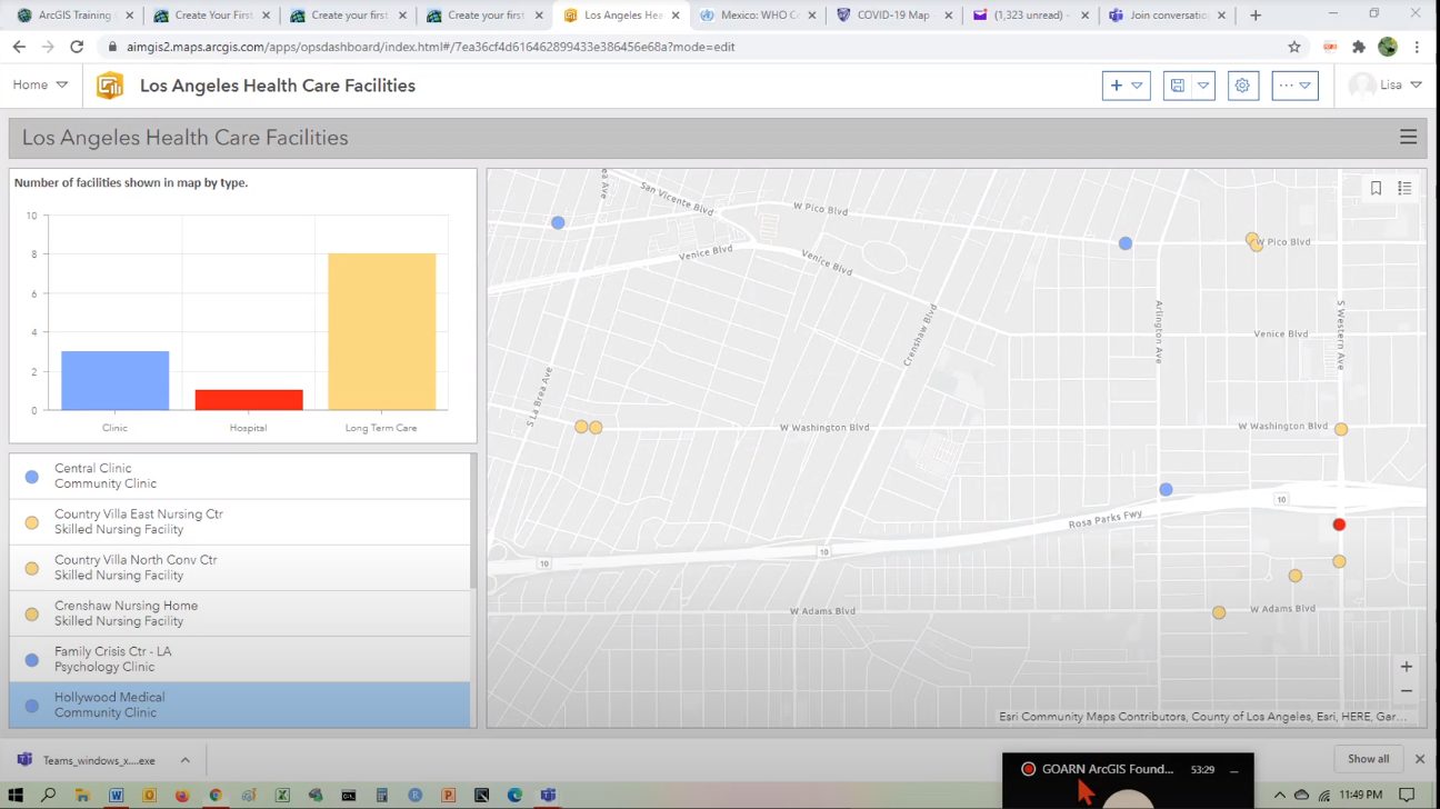
GISCorps volunteers Lisa Silva and Noah Krach conducted several short-term online GIS training sessions between July 14th and August 4th for 43 individuals from the Global Outbreak Alert and Response Network (GOARN) of the World Health Organization (WHO). The training…

GISCorps volunteers contributed to this project by creating polygons of parking lots that are visible from space and indicative of human activity level changes. The project is using the volunteers’ products to track the temporal variation of such human activity over the polygons.

Hurricane Hanna became the first hurricane of the 2020 season on July 25,2020, brining heavy rain and storm surge flooding to South Texas. The National Alliance for Public Safety GIS Foundation (NAPSG) requested support from GISCorps volunteers for the long-standing…

A grassroots volunteer group in South India requested GIS and data analysis support to study the distribution and patterns of noncommunicable diseases in Bangalore (Bengaluru), a fast-growing metropolis and the capital of Karntaka Province. Volunteer Cole White took on this…

Tropical Storm Cristobal formed in the Bay of Campeche on June 1st. After impacting Mexico, it moved north across the Gulf of Mexico and made landfall in Southeastern Louisiana on June 7, 2020. On June 5 in advance of the…
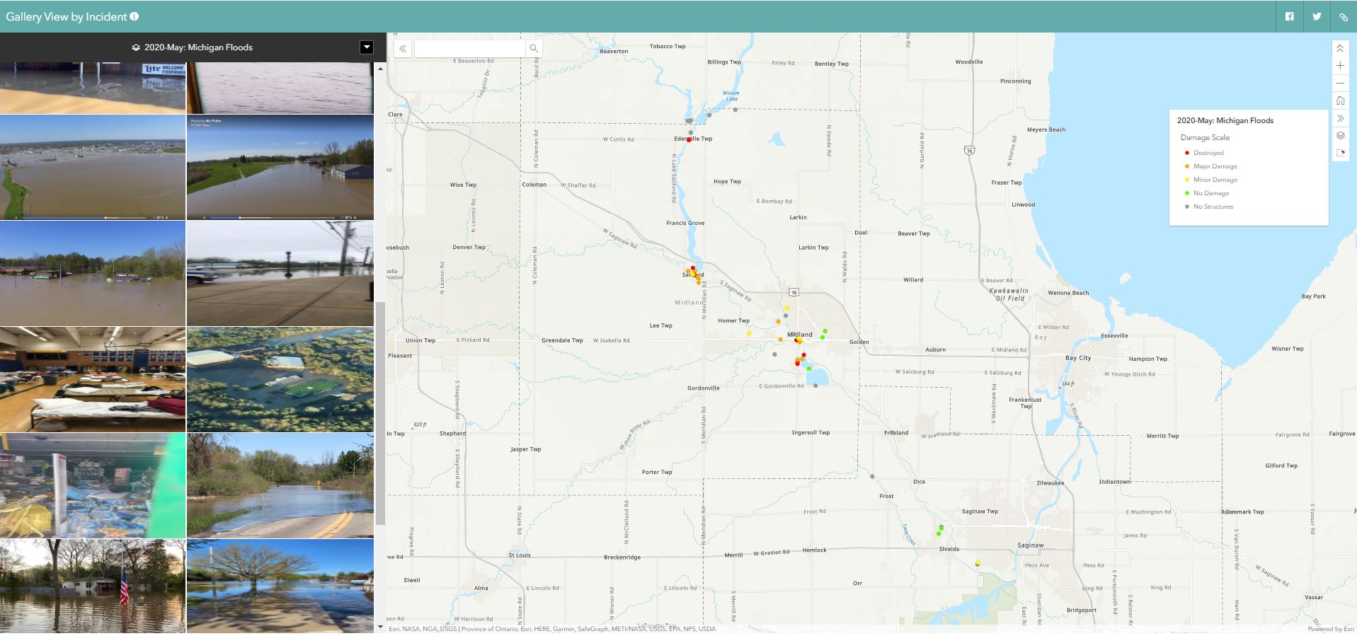
On May 19th, two dams on Central Michigan’s Tittabawassee River failed after days of heavy rain inundated the area, forcing the evacuations of the towns of Edenville, Sanford, and Midland. NAPSG Foundation once again called on GISCorps to help map…
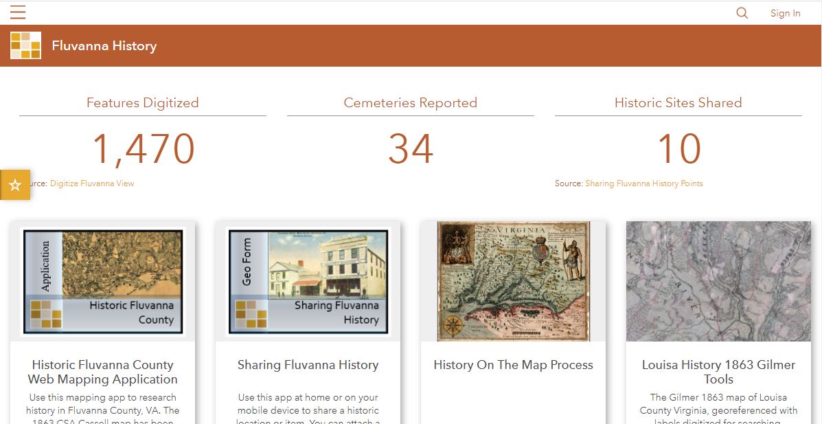
One Shared Story is a volunteer-based non-profit organization founded in 2018. One Shared Story volunteers assist community groups in researching, preserving, and curating hidden histories. 18th and 19th century documents omit full names of women, enslaved persons, and people of…