
Highway 13 Butterfly Trail (HBT) is a community-driven conservation and tourism initiative located along Highway…
Mountain Province is one of the five provinces of the Philippines Cordillera Administrative Region (CAR). In support to the country’s commitment to the Sendai Framework for Disaster Risk Reduction (2015-2030), the Provincial Government of Mountain Province created the Mountain Province Risk Reduction and Management Office (MP-DRRMO) in September 2015 with three divisions: Research & Planning, Administration & Training, and Operations and Warning. The office is mandated to be in charge of the Disaster Risk Reduction and Management Program in the province. The office sets the direction, development, implementation, and coordination of disaster risk reduction and management program in the province.
As one of the office’s aim is to properly and efficiently address disaster risk reduction through research, technology, and science, the Research and Planning Division of the MP-DRRMO wanted to incorporate GIS-based decision making in their operations to strengthen pre- and post-disaster operations. Jameal Magno, a GISCorps volunteer in the Philippines, provided a 3-month live training sessions to MP-DRRMO personnel on GIS. The training sessions were designed around MP-DRRMO long-term plans and desired outputs, such as creating hazard, risk, exposure, and vulnerability maps for earthquakes, typhoons, and El Nino; developing 3D visualizations; and building online interactive maps for their Emergency Operations Center. Scientific principles and Geosciences fundamentals were also discussed during the training sessions to strengthen their critical thinking using GIS. Although the main focus of the training was on QGIS, Jameal also exposed MP-DRRMO staff on other GIS platforms, such as Esri, Google Earth, Blender, HEC-RAS, and AutoCAD.
Screenshot of training on site analysis.
Training on image classification – supervised vs unsupervised classification.
After the 3-month live training sessions, Jameal provided a 6-month technical support as MP-DRRMO staff put what they learned to use.
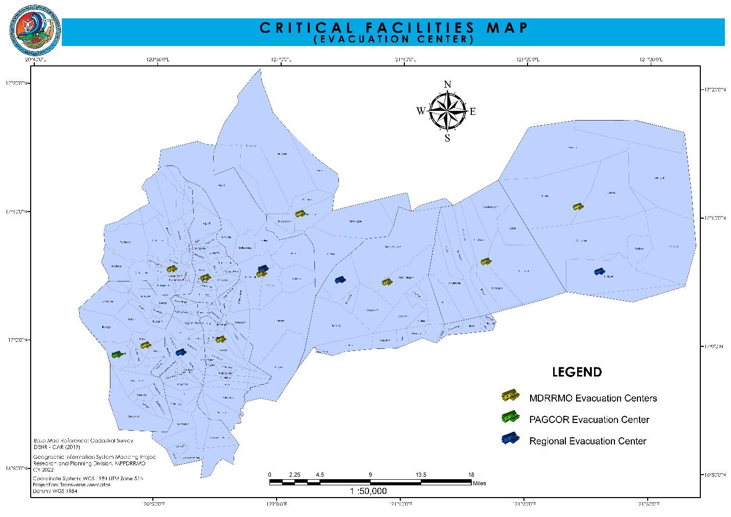
Critical facility map showing locations of evacuation centers created by MP-DRRMO after initial training.
Landcover map created by MP-DRRMO to study potential exposure to disaster risk.
With natural disasters occurring more frequently in high intensity, the MP-DRRMO vision to give importance, invest in, and incorporate advanced GIS technologies into disaster planning and response framework cannot be overstated. Jameal’s effort has made MP-DRRMO and its partnering jurisdictions GIS-aware and GIS-enabled. MP-DRRMO staff now has the ability to transform massive amounts of data into meaningful insights and to effectively convey the results.
Project completed.

Related Missions