
GISCorps has partnered with TechSoup, an organization focused on empowering nonprofits with technology to build…
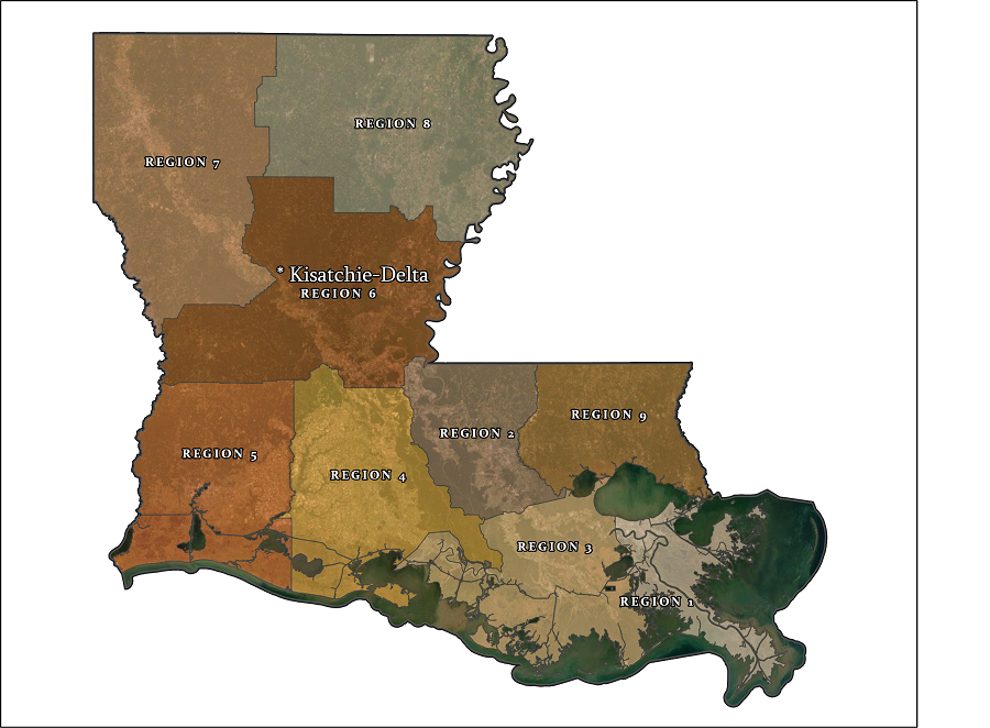
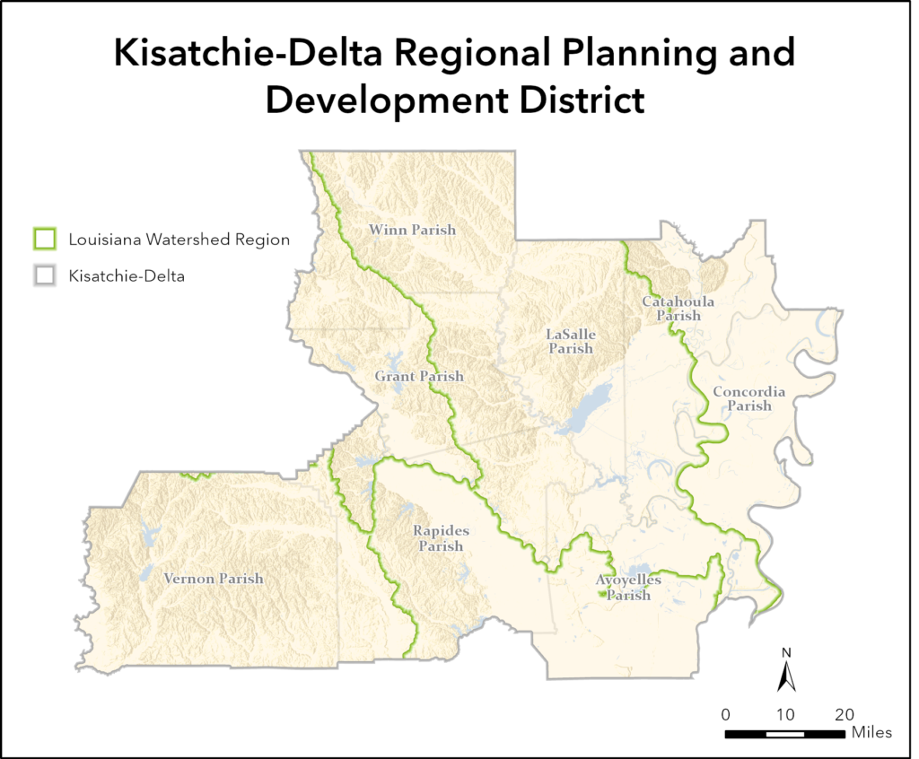
The Kisatchie-Delta Regional Planning and Development District is located in central Louisiana and is comprised of eight parishes. They are chartered by the US EDA as an Economic Development District. The Kisatchie-Delta Regional Planning and Development District encompasses 55 governments, and two federally recognized indigenous tribes. The district assists local government assess public sector development, with an emphasis on assisting community economic development and small businesses within the region.
Kisatchie-Delta had previously utilized geographic information systems (GIS), in multiple areas such as broadband mapping, watershed management, infrastructure management, economic analysis, and more. To support both these ongoing projects, in addition to those short-term, the district was interested to further integrate GIS into their daily work at a higher capacity.
During Phase I of GISCorps mission with Kisatchie-Delta, volunteer Mary Cadena evaluated and created a GIS Needs Assessment for the district. This was supplemented by individual sessions where basic GIS support and instructions were offered within the ArcGIS environment by the second volunteer, Raina Monaghan, a GIS professional from Illinois.
Phase II of the project involved further instructions on GIS terminology, concepts, workflows, and best practices in ArcGIS Pro and ArcGIS Online (AGO), in addition to downloading spatial and tabular data requested by the organization.
Through one-on-one sessions with Kisatchie-Delta staff in Phase II, concepts were reviewed and demonstrations for workflows/tools were given in ArcGIS Pro and AGO. Basics such as coordinate reference systems, projections, data types and software navigation were covered before completing 3 impending Kisatchie-Delta GIS projects. These projects required data extraction, feature editing and feature manipulation. While completing these projects, useful tools, layer overlay, symbology and layout best practices were encountered and covered. Storage and organization recommendations were given.
Remaining training sessions concentrated on essential GIS tools requested to be covered by Kisatchie-Delta, such as: overlay tools, acquiring and importing raster files, geocoding, georeferencing, different methods of querying, labeling, buffering, joins, data conversion, generating summary statistics and more. Some techniques to increase efficiency within ArcGIS Pro were demonstrated, such as through batch processing and the use of Model Builder. Kisatchie-Delta staff was shown how to transfer their data onto AGO and create simple maps.
Lastly, instructional resources were prepared and data sources for requested datasets were acquired.
Project Complete.
Related Missions


