
Keep Bermuda Beautiful (KBB) is a non-profit organization with a mission to engage individuals to…
Arts Midwest is a nonprofit regional arts organization that supports creativity, connection, and access to the arts across the Midwest. Through grantmaking and related programs, Arts Midwest works with artists, organizations, and communities to strengthen arts participation and cultural opportunity across its region.
Needs and Goals
Arts Midwest needed support updating and refining an internal ArcGIS Dashboard that displays grant awardee organizations across nine states. The dashboard was intended to help staff and approved organizational users view awardee locations, explore grant programs and fiscal years, and understand geographic context using related county-level indicators and gap-analysis layers.
The main goals of the mission were to update the awardee data, improve the dashboard user experience, verify map and dashboard functionality, calculate and connect supporting indicator fields, document the workflow, and prepare transfer knowledge materials so Arts Midwest could maintain the project after the GISCorps mission ended.
Work Completed
The GISCorps volunteer supported Arts Midwest by working across data preparation, mapping, dashboard design, quality assurance, and documentation. The project required careful review of awardee records, address and coordinate handling, geocoding, calculated fields, spatial joins, appending new records, hosted layer updates, dashboard testing, and preparation of handover materials.
Deliverables
- Updated internal Arts Midwest Grant Programs Dashboard for nine states.
- Updated awardee organization layer and supporting dashboard map layers.
- Calculated county indicator and gap-analysis fields for poverty, broadband access, high school graduation, and related dashboard categories.
- User Guide Download option added to the dashboard header.
- User-Guide tab added in the dashboard map tab section, and Access Data / Export Data retained so approved users can view and download awardee data within the organization.
- Transfer Knowledge document describing future update, QA, and publishing workflows.
- ArcGIS Pro project package and source data files for future maintenance.
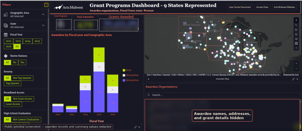
Figure 1. Redacted dashboard preview showing the main dashboard layout, map, chart, awardee list, header buttons, and dashboard tabs. This showcases an incomplete sample data set, with sensitive awardee details and exact values hidden for public sharing.
The dashboard is designed to help Arts Midwest view where awardee organizations are located and explore those locations alongside community and geographic context. The awardee point layer supports the main map, summary cards, popups, awardee list, charts, and export/access data views. County indicator fields support gap-analysis tabs and filters for high poverty, broadband access, and graduation-related categories. Congressional District, Native Nations, and rural/place layers provide additional context for understanding awardee distribution across the region.
How Arts Midwest Will Benefit
The completed dashboard and related handover materials provide Arts Midwest with a clearer and more maintainable way to explore awardee activity across its nine-state region. Approved staff and organizational users can review grant awardees by program, year, geography, and county-level context while using dashboard filters and gap-analysis views to better understand awardee distribution.
The user guide helps viewers understand how to navigate the dashboard and access data. The transfer knowledge documentation and project files support long-term sustainability by giving Arts Midwest a repeatable workflow for future updates, including data preparation, geocoding, field calculations, spatial joins, appending new records, QA checks, and publishing updates.
Volunteer Testimonial
“Volunteering with GISCorps on the Arts Midwest dashboard project was a meaningful and rewarding experience. I had the opportunity to apply my GIS, data management, dashboard design, QA, and documentation skills to support a real nonprofit partner. This mission required careful attention to data quality, geocoding, spatial joins, dashboard functionality, and final handover materials. Through this project, I helped improve the dashboard, update awardee data, prepare user guidance, and create transfer knowledge materials so the organization can continue maintaining the project in the future. I am grateful to GISCorps for providing a platform where volunteers can use geospatial skills to make a practical impact.”
Project Completed

Related Missions


