
Overview The PhotoMappers project is in its 10th year of providing situational awareness to federal,…
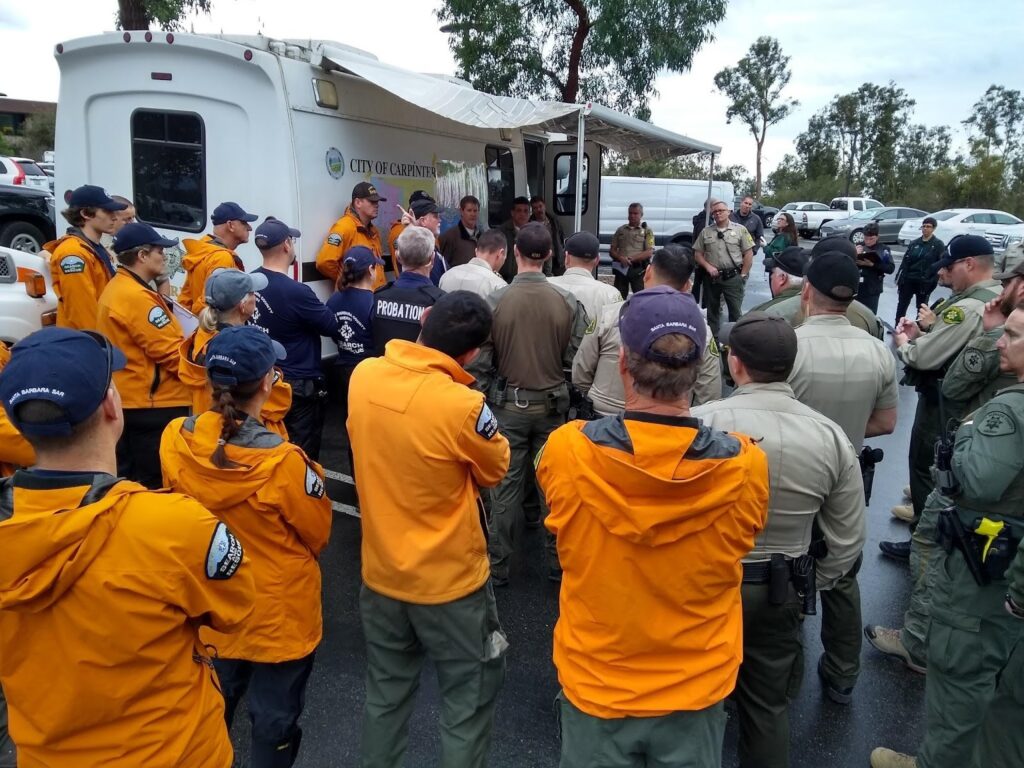
Santa Barbara County Search & Rescue (SBCSAR) is a non-profit volunteer organization dedicated to providing professional Search and Rescue (SAR) capabilities to the Sheriff’s Office and the citizens of Santa Barbara County. Their goal is to locate, access, render aid and provide quality, expedient services to persons in distress and to minimize injury and loss of life.
SBCSAR has the skills and equipment to assist in a variety of emergency situations including: Technical Rope Rescue, Search Management, Search Dogs, Off-Road Operations, Swiftwater & Flood Rescue, Snow & Ice Rescue Operations, Mutual Aid, and Emergency Beacon. Their team undergoes extensive regular training to keep up with the highest standards of SAR operations. In addition, SBCSAR helps the Santa Barbara County Sheriff’s office manage door-to-door notifications during mandatory evacuations in their county.
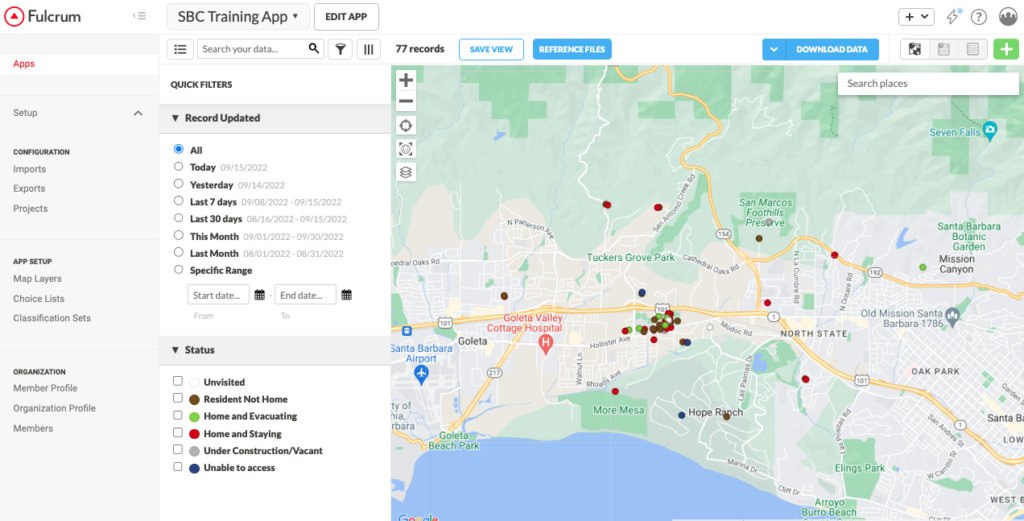
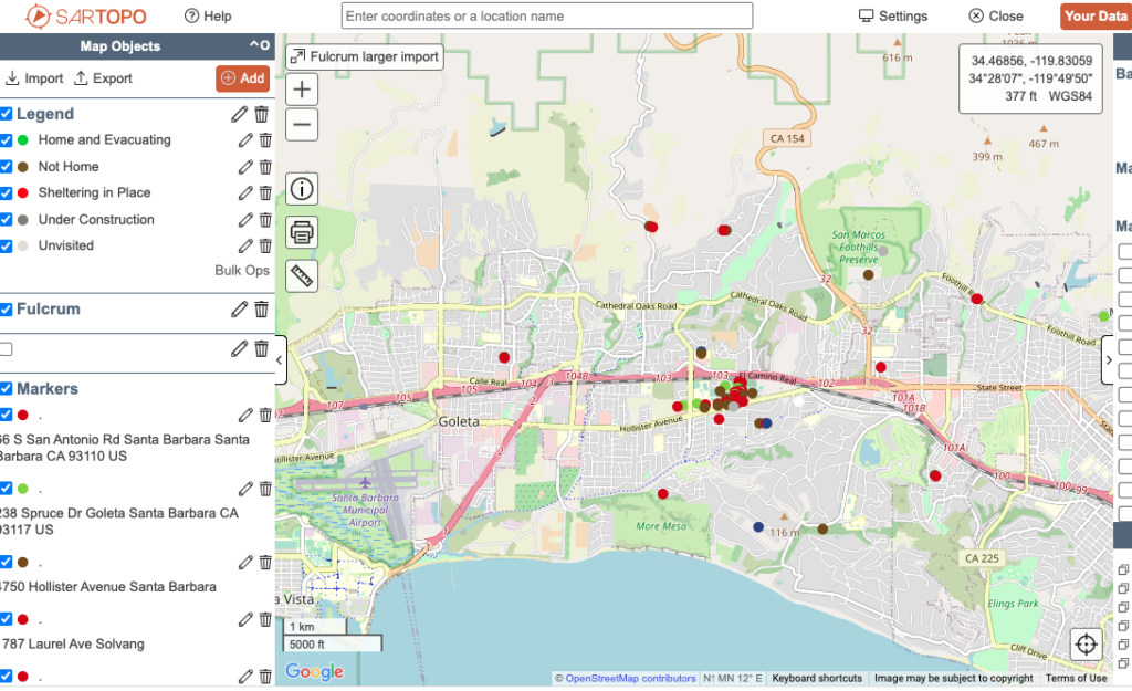
Santa Barbara County Search and Rescue (SBCSAR) has been using the functionality of SARTopo and Fulcrum to facilitate communication during wildfire and other types of mandatory evacuations. Fulcrum is the primary tool for data collection by field staff, while SARTopo is used to display important information (e.g. real-time helicopter locations or vital infrastructure) on a map. The problem with the existing workflow was that an operator would have to consult both a Fulcrum map and a SARTopo map in order to understand what was unfolding during an event. This project provided a way to view the field data being collected in Fulcrum within SARTopo in near real-time via AWS Lambda.
Jeffrey Scarmazzi, a GISCorps volunteer in Virginia, was selected to assist SBCSAR with their spatial challenges.
Fulcrum exposes data as an ArcGIS Feature Service via Koop. Unfortunately, there was not a way to integrate this Feature Service directly into SARTopo and no simple conversion workflows that would bring the data into SARTopo in a reasonable time frame was available. Another issue for the development was that SARTopo does not publicly advertise the API that can be used to automatically update a map SBCSAR would be using during an incident. Fortunately, previous work to automate work in SARTopo had been researched by Tom Grundy for the Nevada County Sheriff’s Search and Rescue. With minor modifications, a function in AWS Lambda was built that queried the ArcGIS Feature Service exposed from Fulcrum and then added “markers” for each of the reported locations at a regular interval. This solution was helpful to SBCSAR because it is readily accessible and is also very easy to configure whenever a new map needs to be set up for an event.
SBCSAR now has a solution which allows incident managers to observe critical evacuation data on a single map.
“GISCorps was instrumental in solving a GIS problem for us that we were challenged to solve on our own. As a result we now have a solution that will make door to door evacuation notifications in Santa Barbara County much easier to track.”
Stephen Dougherty, SBCSAR
Project completed.
Related Missions

