
Walking is one of the simplest ways to connect with a community, yet there can…
22 Volunteers responded to the call for Typhoon Pam
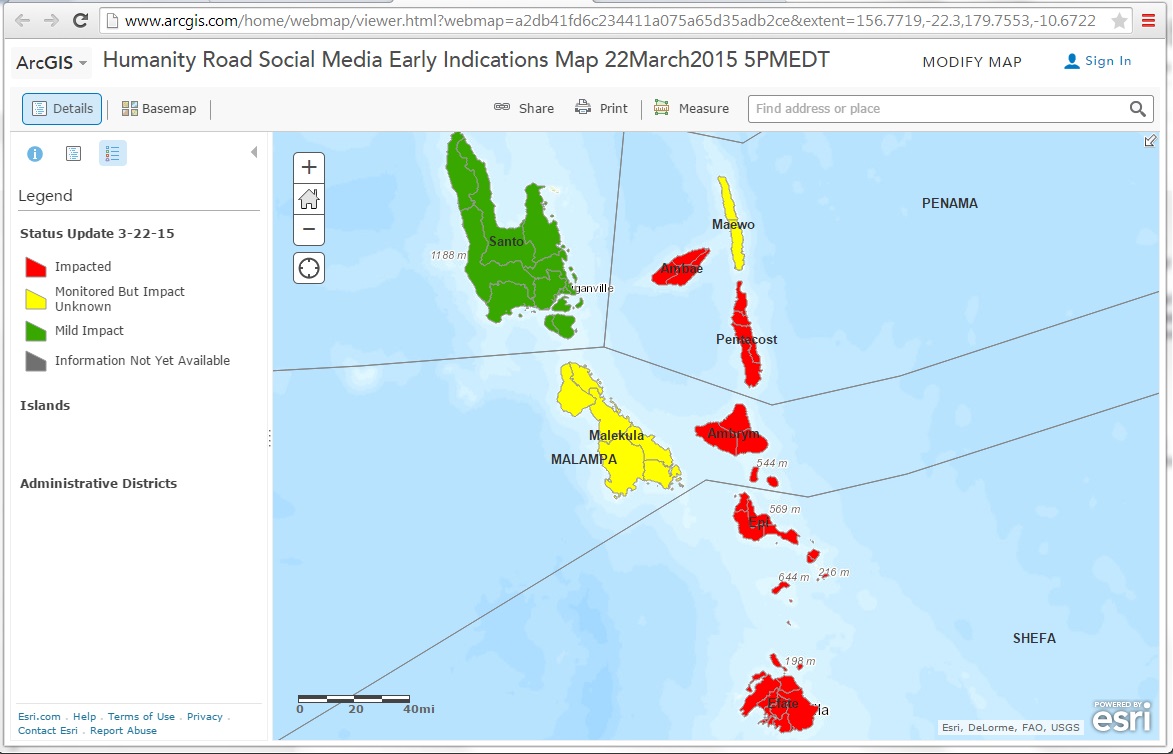
Twenty-two GISCorps volunteers responded to the call for Typhoon Pam, which devastated the island nation of Vanuatu on March 13. The Digital Humanitarian Network was activated by the UN Office for the Coordination of Humanitarian Affairs (UNOCHA) and member organizations formed interdisciplinary teams to quickly monitor, process, and analyze incoming information from social media. GISCorps partnered with Humanity Road and PeaceGeeks to provide spatial context to social media input, resulting in data and maps to share with the humanitarian community. Examples of these data can be seen in two maps created within ESRI ArcGIS Online.
The GISCorps team was led by Heather Milton with additional coordination and technical support from Carol Kraemer and David Litke in the 5-day around-the-clock online operation. Volunteers assisted with geo-locating needed information and creating the maps. The GISCorps team utilized Skype, Google Apps and ArcGIS Online for the effort.
17 Volunteers serving on this project were: Heather Milton, Shannon Cox, Katie Pickett, OmerSaeed, Mihai Patrascu, Alison DeGraff, Jared Pilbeam, Rui Calado Pires, Naveena Wijesekara, DeAnna Hohnhorst, Sonal Raisinghani, Cesare Carloni, Francesco Petrosino, Kazeem Kayode Owolabi, Shamira Ishmael, Nattawadee Panikom, and Carol Kraemer.

Related Missions


